
Project: Shura Marina (Red Sea Global)
Discipline: Preparation / Data Governance
Challenge
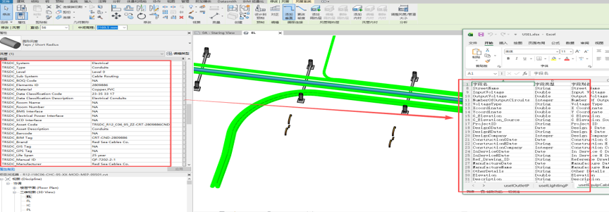
BIM models (Revit) contain rich semantic data but are not natively compatible with enterprise GIS. Without a structured schema, geometry and attributes become fragmented, leading to data loss and inconsistent classification across disciplines.
Solution
A canonical Esri Geodatabase (GDB) was designed per RSG standards, featuring:
- Thematic feature datasets:
BU(Buildings),LC(Landscape),USEL(Electricity),USDC(Communications), etc. - Feature classes mapped 1:1 to BIM categories (e.g., cable trays →
USEL_CableTray, pipes →USWN_Pipe). - Attribute domains and naming conventions enforced across all classes.
- BIM field split logic: every Revit element is classified as point, line, polygon, or solid, then routed to the matching feature class.
Outcome
- A single, versioned GDB per scope delivered to the client.
- Full attribute preservation (including BIM GUID for round-trip traceability).
- Consistent schema enabling cross-project comparison and enterprise integration.